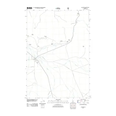
2011 Map of Leadore
USGS Topo · Published 2011About this map
Leadore serves as the central hub of this high-altitude valley, where the Lemhi River meets a network of descending mountain creeks. The settlement pattern here follows the drainage of the Lemhi Valley, with the older site of Junction and its corresponding Junction Cemetery situated just north of the town. These locations, along with Leadville to the east, reflect the early ranching and mining developments of Lemhi County.
Find a feature on this map
29 named features on this map. Tap any name to fly to it.
Don’t see what you’re looking for? This feature index may not catch every label — zoom into the map to look around manually.
Map Details
Editions of this 2011 Leadore Map
This is the sole edition of this map. No revisions or reprints were ever made.
Other maps of this area

1955 · Dubois
USGS Topo · 1:250,000

1956 · Leadore
USGS Topo · 1:62,500

1956 · Morrison Lake
USGS Topo · 1:62,500

1958 · Dubois
USGS Topo · 1:250,000

1965 · Deadman Pass
USGS Topo · 1:24,000

1965 · Bannock Pass
USGS Topo · 1:24,000
1965 · Goat Mountain
USGS Topo · 1:24,000

1980 · Leadore
USGS Topo · 1:100,000
1987 · West of Leadore
USGS Topo · 1:24,000

1987 · Purcell Spring
USGS Topo · 1:24,000