
1987 Map of Purcell Spring
USGS Topo · Published 1987About this map
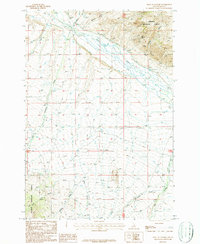
Texas Creek and Eighteenmile Creek define the drainage patterns of this Lemhi County landscape in the late 1980s, where water management is central to the local economy. The presence of Texas Ditch and multiple Fish Hatcheries near Purcell Spring suggests a highly managed aquatic environment, likely supporting regional wildlife or agricultural efforts. On the eastern slopes of Center Ridge, a small Cem stands as a marker of the area's residency, while an Old Railroad Grade traces a path through the valley, indicating former industrial connectivity that had shifted by the time of this survey. This portion of the Salmon National Forest is also marked by numerous Prospects, showing the legacy of mineral exploration that historically shaped these Idaho mountains alongside reliable water sources like Cold Spring and Nez Perce Spring.
Find a feature on this map
23 named features on this map. Tap any name to fly to it.
Don’t see what you’re looking for? This feature index may not catch every label — zoom into the map to look around manually.
Map Details
Editions of this 1987 Purcell Spring Map
This is the sole edition of this map. No revisions or reprints were ever made.
Other maps of this area

1955 · Dubois
USGS Topo · 1:250,000

1956 · Leadore
USGS Topo · 1:62,500

1956 · Morrison Lake
USGS Topo · 1:62,500

1956 · Nicholia
USGS Topo · 1:62,500

1957 · Gilmore
USGS Topo · 1:62,500

1958 · Dubois
USGS Topo · 1:250,000

1980 · Leadore
USGS Topo · 1:100,000

1987 · Gilmore
USGS Topo · 1:24,000
1987 · West of Leadore
USGS Topo · 1:24,000
1987 · Gilmore Summit
USGS Topo · 1:24,000