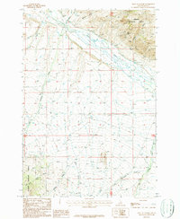
1987 Map of West of Leadore
USGS Topo · Published 1987About this map
The Salmon National Forest dominates the rugged northern and western portions of this 1987 survey, where high-altitude drainages like Mollie Gulch and Stroud Gulch descend toward the valley floor. Resource extraction is evident along the slopes of Mineral Hill, where several Prospects and a Mine Shaft are noted, indicating a history of mineral exploration in the Idaho backcountry. The landscape transitions from these steep forest lands to a broad basin where the Lemhi River meanders, supported by an intricate network of irrigation ditches and canals that define the local agricultural layout.
Find a feature on this map
19 named features on this map. Tap any name to fly to it.
Don’t see what you’re looking for? This feature index may not catch every label — zoom into the map to look around manually.
Map Details
Editions of this 1987 West of Leadore Map
This is the sole edition of this map. No revisions or reprints were ever made.
Other maps of this area

1955 · Dubois
USGS Topo · 1:250,000

1956 · Leadore
USGS Topo · 1:62,500

1956 · Patterson
USGS Topo · 1:62,500

1956 · Lemhi
USGS Topo · 1:62,500

1958 · Dubois
USGS Topo · 1:250,000

1965 · Bannock Pass
USGS Topo · 1:24,000
1965 · Goat Mountain
USGS Topo · 1:24,000

1980 · Leadore
USGS Topo · 1:100,000

1987 · Purcell Spring
USGS Topo · 1:24,000
1987 · Leadore
USGS Topo · 1:24,000