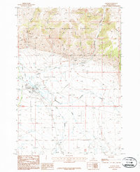
1987 Map of Leadore
USGS Topo · Published 1987About this map
Leadore sits at the junction of mountain and valley, where the foothills of the Salmon National Forest meet the drainage of the Lemhi River. This 1980s landscape is defined by its former industrial and transit corridors, specifically the legacy of the Gilmoure and Pittsburgh Railroad. The Old Railroad Grade and Railroad Grade are prominent features cutting through the terrain, tracing a path south toward the continental divide. Mining history is etched into the northern slopes, where numerous prospects and a Mine Shaft surround the Leadville Site, a named ghost town location. In the valley, water management is evident through a series of siphons and ditches that support the local ranching economy along Eighteenmile Creek and Texas Creek. Genealogists will find the Mc Rea Cem and a second cemetery near the hills, providing valuable markers for local family research in this high-altitude cattle and mining country.
Find a feature on this map
30 named features on this map. Tap any name to fly to it.
Don’t see what you’re looking for? This feature index may not catch every label — zoom into the map to look around manually.
Map Details
Editions of this 1987 Leadore Map
This is the sole edition of this map. No revisions or reprints were ever made.
Other maps of this area

1955 · Dubois
USGS Topo · 1:250,000

1956 · Leadore
USGS Topo · 1:62,500

1956 · Morrison Lake
USGS Topo · 1:62,500

1958 · Dubois
USGS Topo · 1:250,000

1965 · Deadman Pass
USGS Topo · 1:24,000

1965 · Bannock Pass
USGS Topo · 1:24,000
1965 · Goat Mountain
USGS Topo · 1:24,000

1980 · Leadore
USGS Topo · 1:100,000
1987 · West of Leadore
USGS Topo · 1:24,000

1987 · Purcell Spring
USGS Topo · 1:24,000