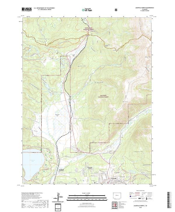
2022 Map of Leadville North
USGS Topo · Published 2022About this map
The northern edge of the historic mining district near Leadville emerges here, bounded by the high peaks of the Sawatch Range and the Continental Divide. This area is defined by its industrial and alpine heritage, where the E Fork Arkansas River flows near Leadville Junction and the sprawling Evergreen Cem. The map illustrates the complex hydrography of the high country, from the massive Turquoise Lake to the high-altitude Big Evans Reservoir and the network of ditches like Wurts Ditch. These water systems, coupled with the legacy of silver and gold mining indicated by named slopes like Fryer Hill and Yankee Hill, reveal how the landscape was engineered to support the booms of the late 19th century. To the north, the transition into the White River National Forest is marked by the critical crossing at Tennessee Pass, a gateway for early mountain transport.
Find a feature on this map
106 named features on this map. Tap any name to fly to it.
Don’t see what you’re looking for? This feature index may not catch every label — zoom into the map to look around manually.
Map Details
Editions of this 2022 Leadville North Map
This is the sole edition of this map. No revisions or reprints were ever made.
Other maps of this area

1889 · Leadville
USGS Topo · 1:125,000

1891 · Leadville
USGS Topo · 1:125,000

1934 · Climax
USGS Topo · 1:48,000

1935 · Mount Elbert
USGS Topo · 1:62,500

1938 · Mt. Lincoln
USGS Topo · 1:48,000

1938 · Mount Elbert
USGS Topo · 1:62,500

1939 · Mount Elbert
USGS Topo · 1:62,500

1942 · Leadville
USGS Topo · 1:125,000

1945 · Mount Lincoln
USGS Topo · 1:62,500

1949 · Holy Cross
USGS Topo · 1:62,500