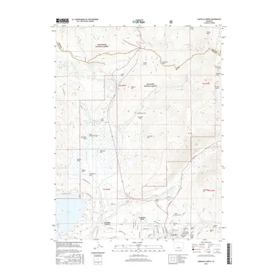
2016 Map of Leadville North
USGS Topo · Published 2016About this map
Evergreen Cem and the residential streets of northern Leadville anchor the southeastern corner of this survey, where the town's urban grid meets the high-elevation terrain of the San Isabel National Forest. The landscape is defined by the headwaters of the Arkansas River and the E Fork Arkansas River, which flow south toward Leadville Junction. To the north, the Continental Divide winds through the peaks, crossing Tennessee Pass near the boundary of the White River National Forest. This region is a complex intersection of historic mining-era land use and modern conservation, featuring a network of gulches and ridges like Fryer Hill and Canterbury Hill that overlook the valley floor. Transportation corridors follow the natural topography, with CO Hwy 24 and various forest roads tracing paths through Tennessee Park and toward the recreational waters of Turquoise Lake.
Find a feature on this map
97 named features on this map. Tap any name to fly to it.
Don’t see what you’re looking for? This feature index may not catch every label — zoom into the map to look around manually.
Map Details
Editions of this 2016 Leadville North Map
This is the sole edition of this map. No revisions or reprints were ever made.
Other maps of this area

1889 · Leadville
USGS Topo · 1:125,000

1891 · Leadville
USGS Topo · 1:125,000

1934 · Climax
USGS Topo · 1:48,000

1935 · Mount Elbert
USGS Topo · 1:62,500

1938 · Mt. Lincoln
USGS Topo · 1:48,000

1938 · Mount Elbert
USGS Topo · 1:62,500

1939 · Mount Elbert
USGS Topo · 1:62,500

1942 · Leadville
USGS Topo · 1:125,000

1945 · Mount Lincoln
USGS Topo · 1:62,500

1949 · Holy Cross
USGS Topo · 1:62,500