
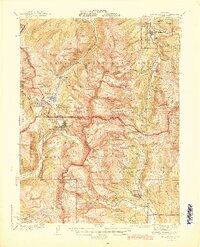
1945 Map of Mount Lincoln
USGS Topo · Published 1945About this map
Breckenridge and the high-altitude mining district of central Colorado are documented here in detail during the mid-1940s. The landscape is defined by the towering peaks of the Tenmile Range and Mosquito Range, where mining activity is evidenced by numerous Mineral Survey landmarks like USLM Quartzville and USLM Bartlett. The presence of the Southern Pacific railroad line through Kokomo and Robinson illustrates the critical logistics required to support these industrial outposts near the 11,318-foot summit of Fremont Pass.
Find a feature on this map
141 named features on this map. Tap any name to fly to it.
Don’t see what you’re looking for? This feature index may not catch every label — zoom into the map to look around manually.
Map Details
Editions of this 1945 Mount Lincoln Map
2 editions found
Other maps of this area

1889 · Leadville
USGS Topo · 1:125,000

1891 · Leadville
USGS Topo · 1:125,000

1924 · Montezuma
USGS Topo · 1:62,500

1926 · Montezuma
USGS Topo · 1:62,500

1929 · Dillon
USGS Topo · 1:62,500

1933 · Montezuma
USGS Topo · 1:62,500

1934 · Climax
USGS Topo · 1:48,000

1934 · Minturn
USGS Topo · 1:62,500

1934 · Dillon
USGS Topo · 1:62,500

1935 · Mount Elbert
USGS Topo · 1:62,500