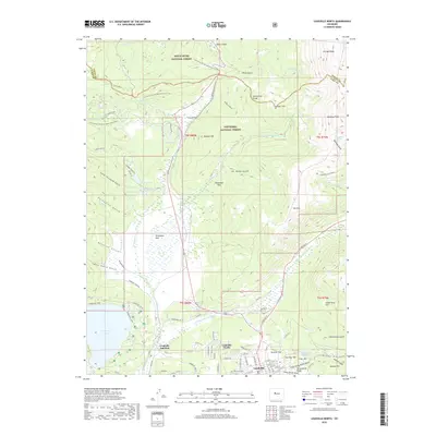
2019 Map of Leadville North
USGS Topo · Published 2019About this map
Leadville and its northern surroundings sit atop the Continental Divide in this 2019 survey, illustrating the high-altitude landscape where the E Fork Arkansas River begins its descent. The map highlights the historic mining districts and residential areas that define the region's character, including Poverty Flat, Fairview Hill, and Yankee Hill. The infrastructure of the area is tied to both transit and water management, featuring the Leadville Junction rail site and the expansive Turquoise Lake and Big Evans Reservoir.
Find a feature on this map
92 named features on this map. Tap any name to fly to it.
Don’t see what you’re looking for? This feature index may not catch every label — zoom into the map to look around manually.
Map Details
Editions of this 2019 Leadville North Map
This is the sole edition of this map. No revisions or reprints were ever made.
Other maps of this area

1889 · Leadville
USGS Topo · 1:125,000

1891 · Leadville
USGS Topo · 1:125,000

1934 · Climax
USGS Topo · 1:48,000

1935 · Mount Elbert
USGS Topo · 1:62,500

1938 · Mt. Lincoln
USGS Topo · 1:48,000

1938 · Mount Elbert
USGS Topo · 1:62,500

1939 · Mount Elbert
USGS Topo · 1:62,500

1942 · Leadville
USGS Topo · 1:125,000

1945 · Mount Lincoln
USGS Topo · 1:62,500

1949 · Holy Cross
USGS Topo · 1:62,500