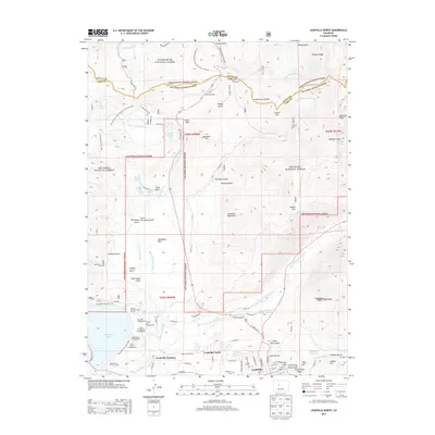
2013 Map of Leadville North
USGS Topo · Published 2013About this map
The Continental Divide defines the high-altitude geography of this region, where the headwaters of the Arkansas River and the South Fork Eagle River emerge from the steep slopes of the White River National Forest. At the southern edge of the map, the legendary mining district of Leadville transitions into residential and industrial zones like Leadville North and Poverty Flat. The legacy of the area's development is visible in the network of water management features such as Wurts Ditch and De Lappe Ditch, which divert alpine runoff across the complex terrain. Recreational history is prominent near the northern heights at Ski Cooper and along the shores of Turquoise Lake, where several campgrounds like the Molly Brown Campground and Baby Doe Campground are situated. The presence of Evergreen Cem near the town center provides a point of interest for those researching the deep roots of this high-country community.
Find a feature on this map
108 named features on this map. Tap any name to fly to it.
Don’t see what you’re looking for? This feature index may not catch every label — zoom into the map to look around manually.
Map Details
Editions of this 2013 Leadville North Map
This is the sole edition of this map. No revisions or reprints were ever made.
Other maps of this area

1889 · Leadville
USGS Topo · 1:125,000

1891 · Leadville
USGS Topo · 1:125,000

1934 · Climax
USGS Topo · 1:48,000

1935 · Mount Elbert
USGS Topo · 1:62,500

1938 · Mt. Lincoln
USGS Topo · 1:48,000

1938 · Mount Elbert
USGS Topo · 1:62,500

1939 · Mount Elbert
USGS Topo · 1:62,500

1942 · Leadville
USGS Topo · 1:125,000

1945 · Mount Lincoln
USGS Topo · 1:62,500

1949 · Holy Cross
USGS Topo · 1:62,500