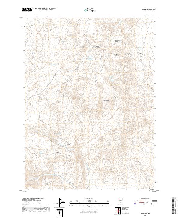
2021 Map of Leadville
USGS Topo · Published 2021About this map
The high-desert terrain of northern Washoe County is defined by the Granite Range and the Hog Ranch Mountains in this topographic survey. The landscape is characterized by its vital water sources, with names like Leadville Springs, Warm Spring, and Chicken Spring indicating the critical importance of water for survival and transit in this arid region. Man-made improvements for livestock or early travelers are evident at the Leadville Troughs and Heward Troughs, located in the shadow of Leadville Mtn. Drainage systems such as N Fork Negro Cr and Middle Fork Negro Cr carve through the canyons, while prominent landmarks like Buckhorn Peak and the deep incision of Willow Creek Canyon provide orientation across the high elevations. This area serves as a primary example of Great Basin geography where seasonal flow and permanent springs dictated the footprint of early habitation and high-country ranching.
Find a feature on this map
26 named features on this map. Tap any name to fly to it.
Don’t see what you’re looking for? This feature index may not catch every label — zoom into the map to look around manually.
Map Details
Editions of this 2021 Leadville Map
This is the sole edition of this map. No revisions or reprints were ever made.
Other maps of this area

1886 · Granite Range
USGS Topo · 1:250,000

1889 · Long Valley
USGS Topo · 1:250,000

1894 · Granite Range
USGS Topo · 1:250,000

1954 · Vya
USGS Topo · 1:250,000

1955 · Lovelock
USGS Topo · 1:250,000

1958 · Vya
USGS Topo · 1:250,000

1959 · Lovelock
USGS Topo · 1:250,000

1962 · Vya
USGS Topo · 1:250,000

1979 · Butte Spring
USGS Topo · 1:24,000
1979 · Chester Lyons Spring
USGS Topo · 1:24,000