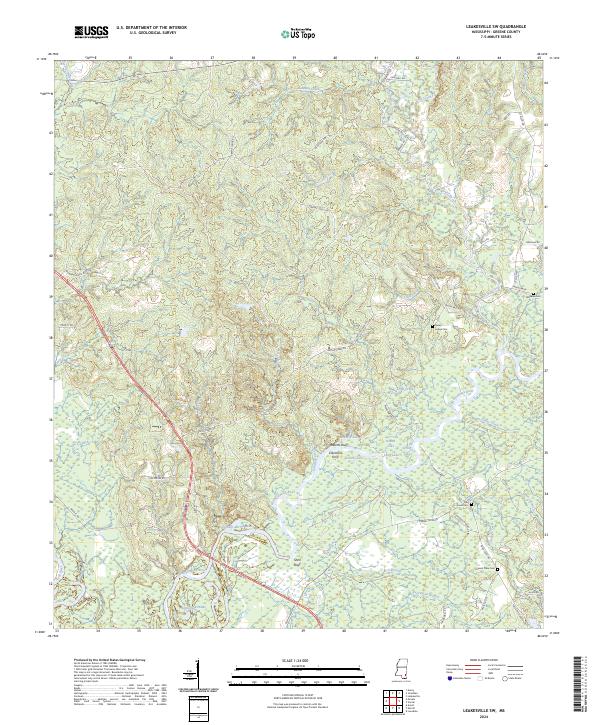
2024 Map of Leakesville SW
USGS Topo · Published 2024About this map
The Chickasawhay River dominates this landscape, winding through a complex network of wetlands and oxbows such as Rattlesnake Lake, Colonel Merrill Lake, and Redbird Lake. This riverine environment defines the local geography, where historic river crossings and high ground landmarks like Colemans Ferry, Roberts Bluff, and Shell Bluff once dictated movement through the Greene County backcountry. The terrain is a mosaic of small tributaries, including Hammill Creek and Big Creek, that drain into the larger river system, creating a distinct pattern of isolated ridges and fertile bottomlands.
Find a feature on this map
67 named features on this map. Tap any name to fly to it.
Don’t see what you’re looking for? This feature index may not catch every label — zoom into the map to look around manually.
Map Details
Editions of this 2024 Leakesville SW Map
This is the sole edition of this map. No revisions or reprints were ever made.
Other maps of this area

1941 · Lucedale
USGS Topo · 1:62,500

1943 · Lucedale
USGS Topo · 1:62,500

1947 · Beaumont
USGS Topo · 1:62,500

1947 · Benndale
USGS Topo · 1:62,500

1949 · Beaumont
USGS Topo · 1:62,500

1949 · Benndale
USGS Topo · 1:62,500

1953 · Hattiesburg
USGS Topo · 1:250,000

1953 · Mobile
USGS Topo · 1:250,000

1957 · Mobile
USGS Topo · 1:250,000

1958 · Hattiesburg
USGS Topo · 1:250,000