
1947 Map of Benndale
USGS Topo · Published 1966About this map
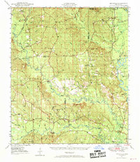
Pascagoula River meanders through the eastern edge of this landscape, its path defined by numerous oxbows such as Davis Dead River and McRea Dead River. The 1947 topography reveals a rural Mississippi interior dominated by the De Soto National Forest, where the transition from dense forest to swampy bottoms is marked by features like Spogett Bay. Settlers and families are represented through numerous small cemeteries and landmarks, including Indian Cem, Thomas Cem, and Alexander Bridge.
Find a feature on this map
72 named features on this map. Tap any name to fly to it.
Don’t see what you’re looking for? This feature index may not catch every label — zoom into the map to look around manually.
Map Details
Editions of this 1947 Benndale Map
2 editions found
Other maps of this area

1941 · Vancleave
USGS Topo · 1:62,500

1941 · Lucedale
USGS Topo · 1:62,500

1943 · Lucedale
USGS Topo · 1:62,500

1943 · Vancleave
USGS Topo · 1:62,500

1944 · Vancleave
USGS Topo · 1:62,500

1947 · Beaumont
USGS Topo · 1:62,500

1947 · Wiggins
USGS Topo · 1:62,500

1947 · New Augusta
USGS Topo · 1:62,500

1949 · Wiggins
USGS Topo · 1:62,500

1949 · Beaumont
USGS Topo · 1:62,500