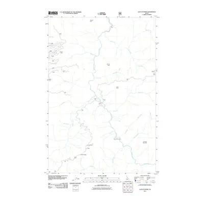
2011 Map of Lean-to Point
USGS Topo · Published 2011About this map
Weitas Creek flows through the center of this Idaho County landscape, serving as the primary drainage for a network of tributaries including Doris Creek and Slick Creek. The terrain is characterized by prominent high points and ridges, such as Lean-to Point and Lean-To Ridge in the southwest and Johnagan Mountain in the southeast. This area is defined by its backcountry access points, with the Horse Pack Bridge crossing the main creek near the confluence of Lean Creek. Several temporary or seasonal settlements are noted, including Horse Camp in the northeast and Wedge Camp near Middle Creek. The distribution of these camps and named features like Bighorn Point and Johnny Butte suggests a landscape utilized for traditional mountain passage and recreation within the national forest system during the early twenty-first century.
Find a feature on this map
28 named features on this map. Tap any name to fly to it.
Don’t see what you’re looking for? This feature index may not catch every label — zoom into the map to look around manually.
Map Details
Editions of this 2011 Lean-to Point Map
This is the sole edition of this map. No revisions or reprints were ever made.
Other maps of this area

1911 · Lolo
USGS Topo · 1:250,000

1913 · Lolo
USGS Topo · 1:250,000

1923 · Washington Creek
USGS Topo · 1:125,000

1924 · Weippe
USGS Topo · 1:125,000

1956 · Hamilton
USGS Topo · 1:250,000

1959 · Hamilton
USGS Topo · 1:250,000

1960 · Hamilton
USGS Topo · 1:250,000

1963 · Clarke Mtn
USGS Topo · 1:24,000

1964 · Hamilton
USGS Topo · 1:250,000

1965 · Junction Mtn
USGS Topo · 1:24,000