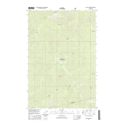
2017 Map of Lean-to Point
USGS Topo · Published 2017About this map
Clearwater National Forest dominates this section of the Idaho backcountry, where steep drainages and high points define the landscape of the early 21st century. The map centers on the Lean-to Point and its associated Lean-To Ridge, marking a significant divide between numerous mountain drainages. The Horse Pack Bridge crossing Weitas Creek illustrates the importance of non-motorized access in this interior wilderness, while landmarks like Johnny Butte and Doris Butte serve as primary navigational anchors. The drainage pattern is intricate, with Middle Cr and Little Weitas Cr flowing through deep valleys separated by prominent features such as Johnagan Mtn and Cabin Point. This survey provides a precise record of the road network, including Co Rd 220, providing access to these high-elevation forest lands.
Find a feature on this map
35 named features on this map. Tap any name to fly to it.
Don’t see what you’re looking for? This feature index may not catch every label — zoom into the map to look around manually.
Map Details
Editions of this 2017 Lean-to Point Map
This is the sole edition of this map. No revisions or reprints were ever made.
Other maps of this area

1911 · Lolo
USGS Topo · 1:250,000

1913 · Lolo
USGS Topo · 1:250,000

1923 · Washington Creek
USGS Topo · 1:125,000

1924 · Weippe
USGS Topo · 1:125,000

1956 · Hamilton
USGS Topo · 1:250,000

1959 · Hamilton
USGS Topo · 1:250,000

1960 · Hamilton
USGS Topo · 1:250,000

1963 · Clarke Mtn
USGS Topo · 1:24,000

1964 · Hamilton
USGS Topo · 1:250,000

1965 · Junction Mtn
USGS Topo · 1:24,000