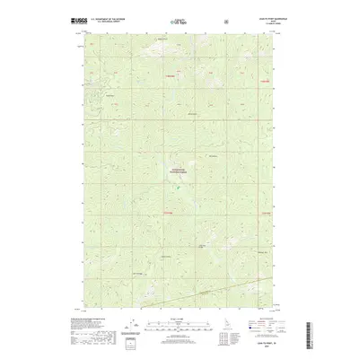
2020 Map of Lean-to Point
USGS Topo · Published 2020About this map
Clearwater National Forest dominates this section of north-central Idaho, where the Clearwater and Idaho county lines meet. The landscape is defined by a dense network of watercourses and high ridges, providing a clear look at the drainage patterns of Weitas Creek and its many tributaries, including Slick Cr and Doris Cr. This 2020 survey illustrates a wilderness largely devoid of modern development, instead highlighting terrain features such as Lean-to Point, Lean-To Ridge, and Johnagan Mtn. A significant human waypoint in this backcountry is the Horse Pack Bridge, which crosses Weitas Creek in the south-central portion of the map. Other prominent landmarks like Johnny Butte and Cabin Point serve as essential navigational markers for those tracing old trails or forest service routes through this isolated mountain geography.
Find a feature on this map
34 named features on this map. Tap any name to fly to it.
Don’t see what you’re looking for? This feature index may not catch every label — zoom into the map to look around manually.
Map Details
Editions of this 2020 Lean-to Point Map
This is the sole edition of this map. No revisions or reprints were ever made.
Other maps of this area

1911 · Lolo
USGS Topo · 1:250,000

1913 · Lolo
USGS Topo · 1:250,000

1923 · Washington Creek
USGS Topo · 1:125,000

1924 · Weippe
USGS Topo · 1:125,000

1956 · Hamilton
USGS Topo · 1:250,000

1959 · Hamilton
USGS Topo · 1:250,000

1960 · Hamilton
USGS Topo · 1:250,000

1963 · Clarke Mtn
USGS Topo · 1:24,000

1964 · Hamilton
USGS Topo · 1:250,000

1965 · Junction Mtn
USGS Topo · 1:24,000