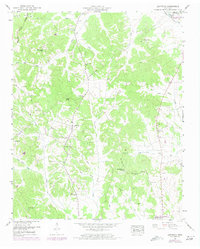
1949 Map of Leapwood
USGS Topo · Published 1973About this map
Leapwood stands at the center of this rural McNairy County landscape, situated amidst a dense network of tributaries that feed into the local creek systems. The terrain is characterized by prominent high points such as Bald Knob and Rocky Knob, which overlook a complex hydrology including White Oak Creek and the southern flow of Snake Creek. This mid-century survey captures the settlement patterns of West Tennessee before significant modern expansion, highlighting small communities like Melton and Clover Hill.
Find a feature on this map
52 named features on this map. Tap any name to fly to it.
Don’t see what you’re looking for? This feature index may not catch every label — zoom into the map to look around manually.
Map Details
Editions of this 1949 Leapwood Map
2 editions found
Other maps of this area

1936 · Leapwood
USGS Topo · 1:24,000

1936 · Sardis
USGS Topo · 1:24,000

1936 · Milledgeville
USGS Topo · 1:24,000

1936 · Enville
USGS Topo · 1:24,000

1936 · Pittsburg Landing
USGS Topo · 1:24,000

1936 · Purdy
USGS Topo · 1:24,000

1936 · Stantonville
USGS Topo · 1:24,000

1936 · Mt. Peter
USGS Topo · 1:24,000

1949 · Pittsburg Landing
USGS Topo · 1:24,000

1949 · Leapwood
USGS Topo · 1:24,000