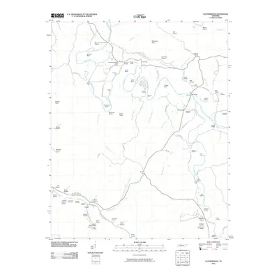
2010 Map of Leatherwood
USGS Topo · Published 2010About this map
The Buffalo River meanders through this portion of Perry County, carving significant geographic features such as Whitaker Bend, Bastin Bend, and Horseshoe Bend. The settlement pattern is defined by small hollows and family homesteads, anchored by the Flatwoods Post Office and the prominent Flat Woods Lookout Tower. Transportation in this era relied on a network of rural routes like Old State Hwy 13 and river crossings including Slink Shoals Ford and Bromley Ford.
Find a feature on this map
110 named features on this map. Tap any name to fly to it.
Don’t see what you’re looking for? This feature index may not catch every label — zoom into the map to look around manually.
Map Details
Editions of this 2010 Leatherwood Map
This is the sole edition of this map. No revisions or reprints were ever made.
Other maps of this area

1905 · Waynesboro
USGS Topo · 1:125,000

1936 · Graves Spring
USGS Topo · 1:24,000

1936 · Eagle Creek
USGS Topo · 1:24,000

1936 · Linden
USGS Topo · 1:24,000

1936 · Leatherwood
USGS Topo · 1:24,000

1936 · Negro Hollow
USGS Topo · 1:24,000

1936 · Clifton
USGS Topo · 1:24,000

1936 · Waynesboro
USGS Topo · 1:24,000

1936 · Topsy
USGS Topo · 1:24,000

1936 · Pope
USGS Topo · 1:24,000