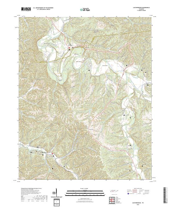
2022 Map of Leatherwood
USGS Topo · Published 2022About this map
Buffalo River winding through the central corridor defines the geography of this rural Tennessee landscape on the border of Perry and Wayne counties. The settlement patterns are distinctly centered around the river and its numerous tributaries, with the village of Flat Woods and the community of Leatherwood serving as primary hubs. The terrain is deeply incised by a network of hollows, including Boldin Hollow and Jack Hollow, which have historically dictated the placement of roads and family homesteads.
Find a feature on this map
125 named features on this map. Tap any name to fly to it.
Don’t see what you’re looking for? This feature index may not catch every label — zoom into the map to look around manually.
Map Details
Editions of this 2022 Leatherwood Map
This is the sole edition of this map. No revisions or reprints were ever made.
Other maps of this area

1905 · Waynesboro
USGS Topo · 1:125,000

1936 · Graves Spring
USGS Topo · 1:24,000

1936 · Eagle Creek
USGS Topo · 1:24,000

1936 · Linden
USGS Topo · 1:24,000

1936 · Leatherwood
USGS Topo · 1:24,000

1936 · Negro Hollow
USGS Topo · 1:24,000

1936 · Clifton
USGS Topo · 1:24,000

1936 · Waynesboro
USGS Topo · 1:24,000

1936 · Topsy
USGS Topo · 1:24,000

1936 · Pope
USGS Topo · 1:24,000