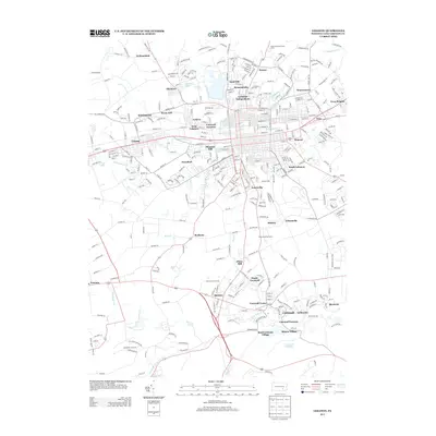
2013 Map of Lebanon
USGS Topo · Published 2013About this map
The Cornwall Furnace stands as a central historical landmark in this southern portion of the Lebanon area, where the legacy of Pennsylvania’s iron industry is etched into the landscape through settlements like Miners Village and Burd Coleman Village. The city of Lebanon Independent and its surrounding neighborhoods, including West Lebanon, Hebron, and Avon, show a dense street grid shaped by the path of Quittapahilla Cr. To the south, the terrain transitions toward the Cornwall Reservoir and the rural community of Quentin. Water remains a defining feature of the topography, from the Ebenezer Lake in the north to the winding course of Snitz Cr and Beck Cr. This survey captures the region's complex local geography, preserved in the names of old milling sites like Zinns Mill and meeting places such as Hokes Meeting House.
Find a feature on this map
340 named features on this map. Tap any name to fly to it.
Don’t see what you’re looking for? This feature index may not catch every label — zoom into the map to look around manually.
Map Details
Editions of this 2013 Lebanon Map
This is the sole edition of this map. No revisions or reprints were ever made.
Other maps of this area

1891 · Lebanon
USGS Topo · 1:62,500

1892 · Hummelstown
USGS Topo · 1:62,500

1893 · Lebanon
USGS Topo · 1:62,500

1899 · Lebanon
USGS Topo · 1:62,500

1902 · Lancaster
USGS Topo · 1:62,500

1904 · Lancaster
USGS Topo · 1:62,500

1908 · Middletown
USGS Topo · 1:62,500

1924 · Hummelstown
USGS Topo · 1:62,500

1943 · Lancaster
USGS Topo · 1:62,500

1943 · Lebanon
USGS Topo · 1:62,500