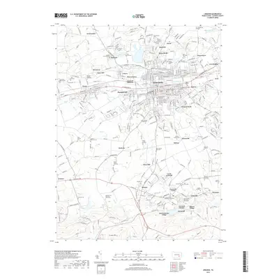
2019 Map of Lebanon
USGS Topo · Published 2019About this map
Lebanon and its surrounding townships are mapped here during a period of modern growth that remains deeply rooted in its colonial and industrial heritage. The landscape is characterized by a high density of family graveyards and denominational cemeteries, such as the Dohner Family Graveyard and Hebron-Moravian Cem, reflecting the area's early German and Mennonite settlement patterns. South of the city, the legacy of the local iron industry is evident near Cornwall Furnace and Miners Village, where the terrain begins to rise into the Furnace Hills. Water remains a central geographic feature, from the winding path of Quittapahilla Cr through the urban center to Ebenezer Lake in the north. This survey provides a precise accounting of the region's complex mix of historic mill sites like Zinns Mill and established residential developments including Pansy Hill and Avon Heights.
Find a feature on this map
79 named features on this map. Tap any name to fly to it.
Don’t see what you’re looking for? This feature index may not catch every label — zoom into the map to look around manually.
Map Details
Editions of this 2019 Lebanon Map
This is the sole edition of this map. No revisions or reprints were ever made.
Other maps of this area

1891 · Lebanon
USGS Topo · 1:62,500

1892 · Hummelstown
USGS Topo · 1:62,500

1893 · Lebanon
USGS Topo · 1:62,500

1899 · Lebanon
USGS Topo · 1:62,500

1902 · Lancaster
USGS Topo · 1:62,500

1904 · Lancaster
USGS Topo · 1:62,500

1908 · Middletown
USGS Topo · 1:62,500

1924 · Hummelstown
USGS Topo · 1:62,500

1943 · Lancaster
USGS Topo · 1:62,500

1943 · Lebanon
USGS Topo · 1:62,500