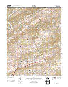
2013 Map of Lebanon
USGS Topo · Published 2013About this map
Lebanon serves as the central hub for this portion of Russell County, where the convergence of modern thoroughfares like Bus 19 and Va-645 meets the enduring natural corridor of Little Cedar Cr. The map illustrates a landscape of deep-set hollows and valleys typical of the Appalachian plateau, including the curiously named Stone Bruise and the industrial imprint of Coal Tipple Holw.
Find a feature on this map
155 named features on this map. Tap any name to fly to it.
Don’t see what you’re looking for? This feature index may not catch every label — zoom into the map to look around manually.
Map Details
Editions of this 2013 Lebanon Map
This is the sole edition of this map. No revisions or reprints were ever made.
Other maps of this area

1886 · Grundy
USGS Topo · 1:125,000

1890 · Grundy
USGS Topo · 1:125,000

1891 · Tazewell
USGS Topo · 1:125,000

1891 · Abingdon
USGS Topo · 1:125,000

1892 · Grundy
USGS Topo · 1:125,000

1894 · Abingdon
USGS Topo · 1:125,000

1895 · Tazewell
USGS Topo · 1:125,000

1897 · Tazewell
USGS Topo · 1:125,000

1897 · Bristol
USGS Topo · 1:125,000

1902 · Bristol
USGS Topo · 1:125,000