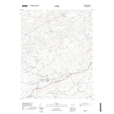
2019 Map of Lebanon
USGS Topo · Published 2019About this map
Lebanon serves as the focal point of this Russell County landscape, centered on the Russell County Courthouse and a dense network of local roads. The town is surrounded by distinct residential and historically significant clusters like Slabtown, Pondtown, and the oddly named Stone Bruise. The geography is defined by the prominent Copper Ridge and Clinch Mountain, which hem in a series of valleys and hollows such as Glade Hollow and Possum Hollow.
Find a feature on this map
130 named features on this map. Tap any name to fly to it.
Don’t see what you’re looking for? This feature index may not catch every label — zoom into the map to look around manually.
Map Details
Editions of this 2019 Lebanon Map
This is the sole edition of this map. No revisions or reprints were ever made.
Other maps of this area

1886 · Grundy
USGS Topo · 1:125,000

1890 · Grundy
USGS Topo · 1:125,000

1891 · Tazewell
USGS Topo · 1:125,000

1891 · Abingdon
USGS Topo · 1:125,000

1892 · Grundy
USGS Topo · 1:125,000

1894 · Abingdon
USGS Topo · 1:125,000

1895 · Tazewell
USGS Topo · 1:125,000

1897 · Tazewell
USGS Topo · 1:125,000

1897 · Bristol
USGS Topo · 1:125,000

1902 · Bristol
USGS Topo · 1:125,000