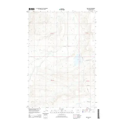
2014 Map of Lebo Lake
USGS Topo · Published 2014About this map
Lebo Lake serves as a focal point in this high-plains landscape of Wheatland County, where the topography is defined by an intricate network of drainage systems. The water flows through several named channels including Big Elk Cr, Alkali Cr, and Crooked Cr, which cut through the terrain north of the lake. To the south, Lebo Cr and the American Fork dominate the hydrology, reflecting the essential nature of water rights and livestock management in this ranching country. Local infrastructure is sparse, characterized by named ranch roads and trails such as Lower Lebo Ranch Rd and Glennie Ranches Trl, alongside the regional Two Dot Hwy. The map provides a clear look at the township and range divisions, showing how land management and transportation like Moonshine Rd follow the natural contours and established property lines of rural Montana.
Find a feature on this map
19 named features on this map. Tap any name to fly to it.
Don’t see what you’re looking for? This feature index may not catch every label — zoom into the map to look around manually.
Map Details
Editions of this 2014 Lebo Lake Map
This is the sole edition of this map. No revisions or reprints were ever made.
Other maps of this area

1886 · Little Belt Mts.
USGS Topo · 1:250,000

1889 · Big Snowy Mountain
USGS Topo · 1:250,000

1893 · Big Snowy Mountain
USGS Topo · 1:250,000

1894 · Little Belt Mts.
USGS Topo · 1:250,000

1897 · Little Belt Mts.
USGS Topo · 1:250,000

1898 · Little Belt Mts.
USGS Topo · 1:250,000

1902 · Little Belt Mts.
USGS Topo · 1:250,000

1948 · White Sulphur Springs
USGS Topo · 1:250,000

1954 · Roundup
USGS Topo · 1:250,000

1958 · Roundup
USGS Topo · 1:250,000