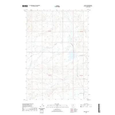
2020 Map of Lebo Lake
USGS Topo · Published 2020About this map
Lebo Lake serves as a central hydrological feature in this portion of Wheatland County, where the plains meet the rising drainage of the Crazy Mountains. The landscape is defined by a network of seasonal and permanent waterways, including Big Elk Cr and the American Fork, which have historically dictated the placement of ranching infrastructure and local transit. The presence of Lower Lebo Ranch Rd and Glennie Ranches Trl reflects the enduring agricultural and pastoral heritage of the region. Transportation routes like the Two-Dot Hwy and Big Elk Rd provide connectivity through this open terrain, while more secluded tracks like Moonshine Rd wind through the draws and coulees. This survey captures a rural Montana landscape where water rights and ranch boundaries, such as those near Lebo Cr, remain the primary drivers of human geography.
Find a feature on this map
19 named features on this map. Tap any name to fly to it.
Don’t see what you’re looking for? This feature index may not catch every label — zoom into the map to look around manually.
Map Details
Editions of this 2020 Lebo Lake Map
This is the sole edition of this map. No revisions or reprints were ever made.
Other maps of this area

1886 · Little Belt Mts.
USGS Topo · 1:250,000

1889 · Big Snowy Mountain
USGS Topo · 1:250,000

1893 · Big Snowy Mountain
USGS Topo · 1:250,000

1894 · Little Belt Mts.
USGS Topo · 1:250,000

1897 · Little Belt Mts.
USGS Topo · 1:250,000

1898 · Little Belt Mts.
USGS Topo · 1:250,000

1902 · Little Belt Mts.
USGS Topo · 1:250,000

1948 · White Sulphur Springs
USGS Topo · 1:250,000

1954 · Roundup
USGS Topo · 1:250,000

1958 · Roundup
USGS Topo · 1:250,000