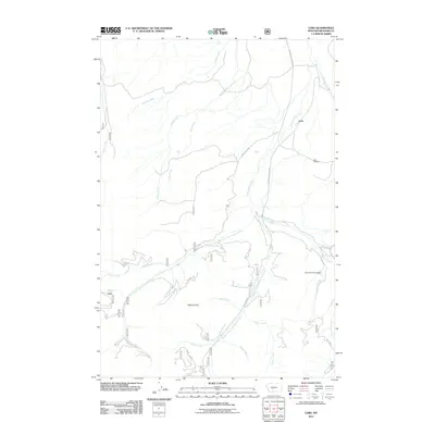
2011 Map of Lebo
USGS Topo · Published 2011About this map
Lebo stands as the primary namesake settlement in this Meagher County landscape, where the drainage of Cottonwood Creek and its various branches dictates the local geography. The map provides a detailed view of the rural infrastructure connecting this area, including Cottonwood Creek Rd and Forest Lake Rd. High points such as Mount Elmo overlook a network of waterways including Loco Creek, Spring Creek, and Middle Fork Cottonwood Creek. Local history is anchored by the Lebo Cemetery and the uniquely named Crazy Sombreo Dam, while the presence of the W Fork Lateral indicates the management of water resources for the region's agricultural or ranching needs. The terrain is marked by numerous seasonal and permanent streams like Muddy Creek and Dale Creek, which carve through the foothills of the Big Belt Mountains.
Find a feature on this map
23 named features on this map. Tap any name to fly to it.
Don’t see what you’re looking for? This feature index may not catch every label — zoom into the map to look around manually.
Map Details
Editions of this 2011 Lebo Map
This is the sole edition of this map. No revisions or reprints were ever made.
Other maps of this area

1886 · Little Belt Mts.
USGS Topo · 1:250,000

1894 · Little Belt Mts.
USGS Topo · 1:250,000

1897 · Little Belt Mts.
USGS Topo · 1:250,000

1898 · Little Belt Mts.
USGS Topo · 1:250,000

1902 · Little Belt Mts.
USGS Topo · 1:250,000

1948 · White Sulphur Springs
USGS Topo · 1:250,000

1951 · Rimrock Divide
USGS Topo · 1:24,000

1958 · White Sulphur Springs
USGS Topo · 1:250,000

1961 · White Sulphur Springs
USGS Topo · 1:250,000

1965 · White Sulphur Springs
USGS Topo · 1:250,000