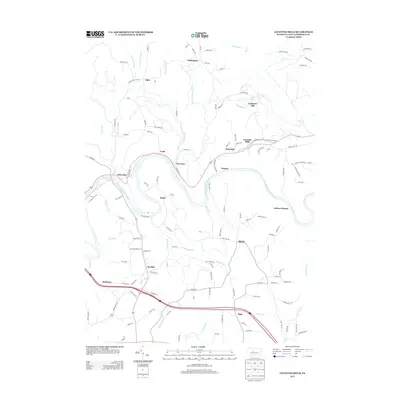
2013 Map of Lecontes Mills
USGS Topo · Published 2013About this map
The W Br Susquehanna River carves a deep, winding path through this portion of Clearfield County, anchoring a landscape defined by small rural settlements and a complex drainage network. Communities such as Lecontes Mills and Shawville are positioned near the river's banks, while higher elevations are marked by places like Congress Hill and Bald Hill. The names on the land, including Gallows Harbor, Needful, and Bishtown, reflect a distinct local history of naming that persists into the 21st century.
Find a feature on this map
127 named features on this map. Tap any name to fly to it.
Don’t see what you’re looking for? This feature index may not catch every label — zoom into the map to look around manually.
Map Details
Editions of this 2013 Lecontes Mills Map
This is the sole edition of this map. No revisions or reprints were ever made.
Other maps of this area

1903 · Houtzdale
USGS Topo · 1:62,500

1905 · Houtzdale
USGS Topo · 1:62,500

1922 · Philipsburg
USGS Topo · 1:62,500

1929 · Karthaus
USGS Topo · 1:62,500

1929 · Clearfield
USGS Topo · 1:48,000

1932 · Clearfield
USGS Topo · 1:62,500

1932 · Karthaus
USGS Topo · 1:62,500

1939 · Philipsburg
USGS Topo · 1:62,500
1944 · Glen Richey
USGS Topo · 1:24,000

1945 · Philipsburg
USGS Topo · 1:62,500
Featured Places
- Goshen Township, PA
- Lawrence Township, PA
- Gallows Harbor, Bradford Township
- Bald Hill, Girard Township
- Bradford Township, PA