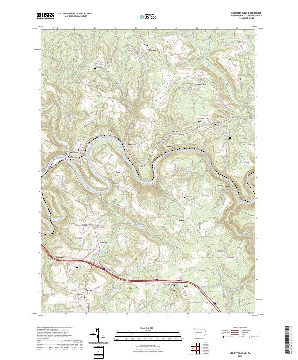
2023 Map of Lecontes Mills
USGS Topo · Published 2023About this map
The West Branch Susquehanna River carves a deep, winding path through this portion of Clearfield County, anchoring a landscape defined by small upland settlements and numerous family and community burial grounds. Several distinct hamlets such as Lecontes Mills, Shawville, and Egypt are situated near the river's bends, while others like Gillingham, Shiloh, and Needful occupy the higher ridges and hollows. The area's genealogical depth is evident in the high density of small cemeteries, including Gillingham Cem, Egypt Cem, Shiloh Cem, and Bradford Cem, often located near crossroads or historic meeting places like Eden Church.
Find a feature on this map
77 named features on this map. Tap any name to fly to it.
Don’t see what you’re looking for? This feature index may not catch every label — zoom into the map to look around manually.
Map Details
Editions of this 2023 Lecontes Mills Map
This is the sole edition of this map. No revisions or reprints were ever made.
Other maps of this area

1903 · Houtzdale
USGS Topo · 1:62,500

1905 · Houtzdale
USGS Topo · 1:62,500

1922 · Philipsburg
USGS Topo · 1:62,500

1929 · Karthaus
USGS Topo · 1:62,500

1929 · Clearfield
USGS Topo · 1:48,000

1932 · Clearfield
USGS Topo · 1:62,500

1932 · Karthaus
USGS Topo · 1:62,500

1939 · Philipsburg
USGS Topo · 1:62,500
1944 · Glen Richey
USGS Topo · 1:24,000

1945 · Philipsburg
USGS Topo · 1:62,500