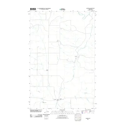
2011 Map of Ledger
USGS Topo · Published 2011About this map
Ledger and Fowler serve as the primary hubs in this agricultural pocket of Pondera County, where the rail lines and regional roads intersect the landscape of the Hi-Line. The Ledger Post Office and nearby Keil Ranch highlight the enduring ranching and mail-service infrastructure that defines this rural Montana community. The terrain is marked by significant water management features, including the Tom McCracken Dam and Cracker Dam, which support local activity near the drainage of the Dry Fork Marias River. Deep coulees such as Swift Coulee and Little Flat Coulee carve through the plains, while a network of rural routes like Liberty School Rd and Depot Rd point to the historic locations of essential community landmarks and transportation nodes.
Find a feature on this map
23 named features on this map. Tap any name to fly to it.
Don’t see what you’re looking for? This feature index may not catch every label — zoom into the map to look around manually.
Map Details
Editions of this 2011 Ledger Map
This is the sole edition of this map. No revisions or reprints were ever made.
Other maps of this area

1920 · Conrad
USGS Topo · 1:125,000

1954 · Shelby
USGS Topo · 1:250,000

1958 · Shelby
USGS Topo · 1:250,000
1967 · Conrad
USGS Topo · 1:24,000

1967 · Naismith
USGS Topo · 1:24,000

1967 · Conrad Butte
USGS Topo · 1:24,000

1967 · Dunkirk
USGS Topo · 1:24,000
1967 · Pioneer School
USGS Topo · 1:24,000

1967 · Fowler Coulee NW
USGS Topo · 1:24,000
1967 · Letz Lake
USGS Topo · 1:24,000