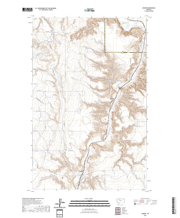
2024 Map of Ledger
USGS Topo · Published 2024About this map
Ledger and Fowler anchor this prairie landscape where Pondera County meets Toole County. The terrain is defined by the deep incisions of the Marias River and its primary tributary, the Dry Fork Marias River, which carve complex drainage patterns through the plateau. Local history is etched into the road network, notably along the Fort Conrad Trl, a route referencing the region's early trading post era. Water management is central to the area's geography, visible in the artificial channels of the S Canal and P Four Ditch that contrast with the natural winding paths of Pearson Coulee, Little Flat Coulee, and Swift Coulee. Named thoroughfares like Liberty School Rd and Depot Rd suggest the locations of former community focal points and transportation hubs in this agricultural corridor between the High Plains and the Sweet Grass Hills.
Find a feature on this map
27 named features on this map. Tap any name to fly to it.
Don’t see what you’re looking for? This feature index may not catch every label — zoom into the map to look around manually.
Map Details
Editions of this 2024 Ledger Map
This is the sole edition of this map. No revisions or reprints were ever made.
Other maps of this area

1920 · Conrad
USGS Topo · 1:125,000

1954 · Shelby
USGS Topo · 1:250,000

1958 · Shelby
USGS Topo · 1:250,000
1967 · Conrad
USGS Topo · 1:24,000

1967 · Naismith
USGS Topo · 1:24,000

1967 · Conrad Butte
USGS Topo · 1:24,000

1967 · Dunkirk
USGS Topo · 1:24,000
1967 · Pioneer School
USGS Topo · 1:24,000

1967 · Fowler Coulee NW
USGS Topo · 1:24,000
1967 · Letz Lake
USGS Topo · 1:24,000