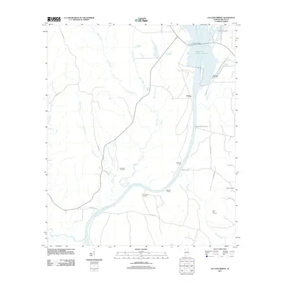
2011 Map of Lee Long Bridge
USGS Topo · Published 2011About this map
The Alabama River and its expansive William 'Bill' Dannelly Reservoir dominate this landscape in Wilcox County, shaping the local economy and geography around water access and river crossings. The Lee Long Bridge serves as a primary transit point over the reservoir, while numerous historical river access points like South Hall Landing, Marsh Landing, and Matthews Landing testify to the area's long-standing connection to the waterway. Near the settlement of Midway, the map reveals a rural pattern of development tied to family histories and local landmarks.
Find a feature on this map
33 named features on this map. Tap any name to fly to it.
Don’t see what you’re looking for? This feature index may not catch every label — zoom into the map to look around manually.
Map Details
Editions of this 2011 Lee Long Bridge Map
This is the sole edition of this map. No revisions or reprints were ever made.
Other maps of this area

1953 · Montgomery
USGS Topo · 1:250,000

1953 · Andalusia
USGS Topo · 1:250,000

1956 · Montgomery
USGS Topo · 1:250,000

1957 · Montgomery
USGS Topo · 1:250,000

1957 · Andalusia
USGS Topo · 1:250,000

1973 · Coy
USGS Topo · 1:24,000

1973 · Pine Hill
USGS Topo · 1:24,000

1973 · Camden South
USGS Topo · 1:24,000

1974 · Crumptonia
USGS Topo · 1:24,000

1974 · Catherine
USGS Topo · 1:24,000