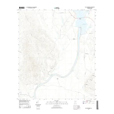
2014 Map of Lee Long Bridge
USGS Topo · Published 2014About this map
The Alabama River and the broad waters of the William 'Bill' Dannelly Reservoir dominate this 2014 landscape in Wilcox County. Near the Lee Long Bridge, the river's path is defined by a network of significant waterways including Henderson Lake and the lower reaches of Dixon Creek. The settlement of Midway sits at a crossroads of regional routes like Al-28 and Al-162, which connect the interior timberlands to the river system. Local history is deeply etched into the topography through numerous family and community burial grounds, such as Mendenhall Cem, Sand Island Cem, and Bones Hill Cem. A reminder of earlier river crossings persists in the name of Clifton Ferry Rd, while the terrain at Sand Island reflects the shifting silt and sand characteristic of this navigable stretch of the river valley.
Find a feature on this map
30 named features on this map. Tap any name to fly to it.
Don’t see what you’re looking for? This feature index may not catch every label — zoom into the map to look around manually.
Map Details
Editions of this 2014 Lee Long Bridge Map
This is the sole edition of this map. No revisions or reprints were ever made.
Other maps of this area

1953 · Montgomery
USGS Topo · 1:250,000

1953 · Andalusia
USGS Topo · 1:250,000

1956 · Montgomery
USGS Topo · 1:250,000

1957 · Montgomery
USGS Topo · 1:250,000

1957 · Andalusia
USGS Topo · 1:250,000

1973 · Coy
USGS Topo · 1:24,000

1973 · Pine Hill
USGS Topo · 1:24,000

1973 · Camden South
USGS Topo · 1:24,000

1974 · Crumptonia
USGS Topo · 1:24,000

1974 · Catherine
USGS Topo · 1:24,000