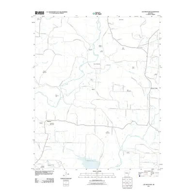
2011 Map of Lee Mountain
USGS Topo · Published 2011About this map
Booger Hollow and the surrounding Pope County hills define this landscape, where the headwaters of Big Piney Creek and Wilson Creek carve through the terrain near Parker Mountain. The map reveals a rural community anchored by small settlements like Piney and Augsburg, each connected by a network of winding county roads such as Worshaw Mountain Dr and Rushing Rd. The geography is dotted with family-named cemeteries, including Brown-Rye Cemetery, Lindsey Cemetery, and Adams Cemetery, which provide essential landmarks for genealogical research in this part of Arkansas.
Find a feature on this map
94 named features on this map. Tap any name to fly to it.
Don’t see what you’re looking for? This feature index may not catch every label — zoom into the map to look around manually.
Map Details
Editions of this 2011 Lee Mountain Map
This is the sole edition of this map. No revisions or reprints were ever made.
Other maps of this area

1888 · Dardanelle #2
USGS Topo · 1:62,500

1888 · Dardanelle #1
USGS Topo · 1:62,500

1889 · Treat
USGS Topo · 1:62,500

1889 · Ozone
USGS Topo · 1:62,500

1890 · Dardanelle
USGS Topo · 1:125,000

1932 · Treat
USGS Topo · 1:62,500

1934 · Treat
USGS Topo · 1:62,500

1934 · Ozone
USGS Topo · 1:62,500

1936 · Ozone
USGS Topo · 1:62,500

1956 · Russellville
USGS Topo · 1:250,000