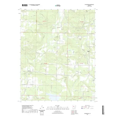
2020 Map of Lee Mountain
USGS Topo · Published 2020About this map
Big Piney Creek and Illinois Bayou dominate the drainage of this Pope County landscape, which transitions from the northern ridges toward the town of Dover. The terrain is defined by a series of named elevations including Augsburg Mtn, Tater Knob, and Bald Knob, with small rural settlements like Augsburg and Piney situated along the valley floors. The distribution of small family burial grounds such as Adams Cem, Howard Cem, and Chesser Cem suggests a long-standing pattern of multi-generational land ownership and dispersed rural homesteading.
Find a feature on this map
117 named features on this map. Tap any name to fly to it.
Don’t see what you’re looking for? This feature index may not catch every label — zoom into the map to look around manually.
Map Details
Editions of this 2020 Lee Mountain Map
This is the sole edition of this map. No revisions or reprints were ever made.
Other maps of this area

1888 · Dardanelle #2
USGS Topo · 1:62,500

1888 · Dardanelle #1
USGS Topo · 1:62,500

1889 · Treat
USGS Topo · 1:62,500

1889 · Ozone
USGS Topo · 1:62,500

1890 · Dardanelle
USGS Topo · 1:125,000

1932 · Treat
USGS Topo · 1:62,500

1934 · Treat
USGS Topo · 1:62,500

1934 · Ozone
USGS Topo · 1:62,500

1936 · Ozone
USGS Topo · 1:62,500

1956 · Russellville
USGS Topo · 1:250,000