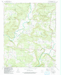
1993 Map of Lee Mountain
USGS Topo · Published 1993About this map
Big Piney Creek carves a deep valley through the Ozark highlands of Pope and Johnson Counties, defining the drainage patterns of this 1993 survey. The settlement of Piney and the distinctive community of Booger Hollow serve as local anchors, the latter featuring the Booger Hollow Tabernacle and the Booger Hollow Community Hall. High points like Lee Mountain, Three Knob Mountain, and Parker Mountain dictate the placement of roads and homesteads, while the southern reaches are dominated by Augsburg Mountain. Numerous family burial grounds, including Adams Cem and the Brown-Rye Cem, are tucked away in the hollows and along the ridges. The landscape is also marked by several country churches such as Zion Ch and Pleasant Grove Ch, reflecting the dispersed but enduring rural social fabric of the region.
Find a feature on this map
41 named features on this map. Tap any name to fly to it.
Don’t see what you’re looking for? This feature index may not catch every label — zoom into the map to look around manually.
Map Details
Editions of this 1993 Lee Mountain Map
This is the sole edition of this map. No revisions or reprints were ever made.
Other maps of this area

1888 · Dardanelle #2
USGS Topo · 1:62,500

1888 · Dardanelle #1
USGS Topo · 1:62,500

1889 · Treat
USGS Topo · 1:62,500

1889 · Ozone
USGS Topo · 1:62,500

1890 · Dardanelle
USGS Topo · 1:125,000

1932 · Treat
USGS Topo · 1:62,500

1934 · Treat
USGS Topo · 1:62,500

1934 · Ozone
USGS Topo · 1:62,500

1936 · Ozone
USGS Topo · 1:62,500

1956 · Russellville
USGS Topo · 1:250,000