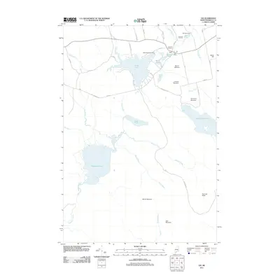
2011 Map of Lee
USGS Topo · Published 2011About this map
Lee serves as the central hub of this Penobscot County landscape, situated near a complex network of managed waterways including Silver Lake, Merrill Pond, and Mill Pond. The geography is defined by a series of prominent elevations, most notably Mount Jefferson and Lookout Mountain north of the village, and Moose Mountain and Bear Mountain to the south. Local heritage is grounded in sites like the Academy Cemetery and Woodlawn Cemetery, while the hydrological infrastructure is marked by the Mattakeunk Pond Dam and Lee Dam. Moving south, the terrain becomes increasingly defined by water and ridges, where Madagascal Pond sits at the base of Twombly Ridge. The road network, including Hale Farm Rd and Gray Knocket Rd, connects these scattered ponds and peaks, illustrating a community long integrated with its timber and water resources.
Find a feature on this map
51 named features on this map. Tap any name to fly to it.
Don’t see what you’re looking for? This feature index may not catch every label — zoom into the map to look around manually.
Map Details
Editions of this 2011 Lee Map
This is the sole edition of this map. No revisions or reprints were ever made.
Other maps of this area

1920 · Winn
USGS Topo · 1:62,500

1931 · Springfield
USGS Topo · 1:48,000

1931 · Saponac
USGS Topo · 1:48,000

1932 · Nicatous Lake
USGS Topo · 1:48,000

1934 · Saponac
USGS Topo · 1:62,500

1934 · Nicatous Lake
USGS Topo · 1:62,500

1934 · Springfield
USGS Topo · 1:62,500

1954 · Millinocket
USGS Topo · 1:250,000

1957 · Saponac
USGS Topo · 1:62,500

1958 · Millinocket
USGS Topo · 1:250,000