2014 Map of Lee
USGS Topo · Published 2014About this map
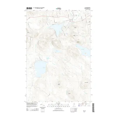
The town of Lee serves as the central hub of this eastern Penobscot County landscape, situated where Mattakeunk Stream flows through a series of water bodies including Merrill Pond and Mill Pond. This 2014 survey documents a region defined by its significant hydrography and high-elevation terrain, featuring prominent landmarks like Mount Jefferson and Lookout Mountain. To the south, the expansive waters of Madagascal Pond and Little Madagascal Pond are surrounded by rising peaks such as Moose Mountain and Bear Mountain. Local history is anchored by the presence of Woodlawn Cem and Acad Cem near the main village. The network of roads, including Hale Farm Rd and Malletts Mill Rd, suggests a long-standing relationship between the community and its natural resources, from early mills to the residential shores of Silver Lake.
Find a feature on this map
60 named features on this map. Tap any name to fly to it.
Don’t see what you’re looking for? This feature index may not catch every label — zoom into the map to look around manually.
Map Details
Editions of this 2014 Lee Map
This is the sole edition of this map. No revisions or reprints were ever made.
Other maps of this area

1920 · Winn
USGS Topo · 1:62,500

1931 · Springfield
USGS Topo · 1:48,000

1931 · Saponac
USGS Topo · 1:48,000

1932 · Nicatous Lake
USGS Topo · 1:48,000

1934 · Saponac
USGS Topo · 1:62,500

1934 · Nicatous Lake
USGS Topo · 1:62,500

1934 · Springfield
USGS Topo · 1:62,500

1954 · Millinocket
USGS Topo · 1:250,000

1957 · Saponac
USGS Topo · 1:62,500

1958 · Millinocket
USGS Topo · 1:250,000