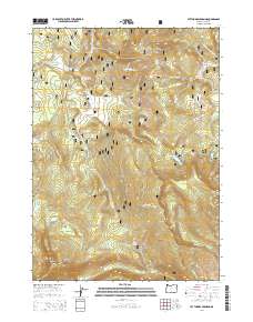
2014 Map of Lee Thomas Crossing
USGS Topo · Published 2014About this map
The Fremont National Forest defines this high-elevation landscape in Lake County, where the N Fork Sprague River and its numerous tributaries like Walker Cr and School Cr carve through the terrain. The map centers on the Lee Thomas Crossing and the nearby Lee Thomas Meadow, reflecting a period of established forest management and recreation within the Oregon backcountry. Remarkable topographic features include the prominent Bald Butte to the north and the jagged Dead Horse Rim overlooking Dead Horse Lake. A complex network of Forest Service roads, including the Natl Forest Develop Road 3372 Rd, provides access to these isolated points. Hydrological interest is concentrated around the Head of River Spring and the southern slopes of Gearhart Mtn, where Dairy Cr and Wagon Wheel Cr originate before flowing across Wagon Wheel Flat.
Find a feature on this map
45 named features on this map. Tap any name to fly to it.
Don’t see what you’re looking for? This feature index may not catch every label — zoom into the map to look around manually.
Map Details
Editions of this 2014 Lee Thomas Crossing Map
This is the sole edition of this map. No revisions or reprints were ever made.
Other maps of this area

1955 · Klamath Falls
USGS Topo · 1:250,000

1958 · Klamath Falls
USGS Topo · 1:250,000

1960 · Fishhole Mtn
USGS Topo · 1:62,500

1964 · Coleman Point
USGS Topo · 1:24,000

1966 · Shake Butte
USGS Topo · 1:24,000

1966 · Slide Mtn
USGS Topo · 1:24,000

1966 · Sandhill Crossing
USGS Topo · 1:24,000

1966 · Harvey Creek
USGS Topo · 1:24,000

1966 · Coffeepot Creek
USGS Topo · 1:24,000

1966 · Lee Thomas Crossing
USGS Topo · 1:24,000