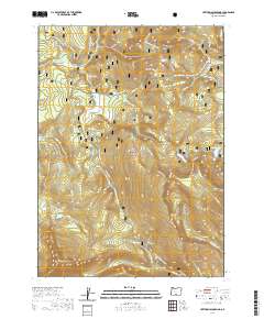
2020 Map of Lee Thomas Crossing
USGS Topo · Published 2020About this map
The North Fork Sprague Wild and Scenic River meanders through this high-elevation landscape within the Fremont National Forest, defining a drainage system that includes Walker Creek and School Creek. The terrain is characterized by dramatic elevation changes, from the prominent summit of Gearhart Mountain in the southwest to the sweeping Dead Horse Rim and Wagon Wheel Flat to the east. These geological features create a basin for isolated water bodies such as Blue Lake and Campbell Lake, alongside specialized environments like Gearhart Marsh.
Find a feature on this map
47 named features on this map. Tap any name to fly to it.
Don’t see what you’re looking for? This feature index may not catch every label — zoom into the map to look around manually.
Map Details
Editions of this 2020 Lee Thomas Crossing Map
This is the sole edition of this map. No revisions or reprints were ever made.
Other maps of this area

1955 · Klamath Falls
USGS Topo · 1:250,000

1958 · Klamath Falls
USGS Topo · 1:250,000

1960 · Fishhole Mtn
USGS Topo · 1:62,500

1964 · Coleman Point
USGS Topo · 1:24,000

1966 · Shake Butte
USGS Topo · 1:24,000

1966 · Slide Mtn
USGS Topo · 1:24,000

1966 · Sandhill Crossing
USGS Topo · 1:24,000

1966 · Harvey Creek
USGS Topo · 1:24,000

1966 · Coffeepot Creek
USGS Topo · 1:24,000

1966 · Lee Thomas Crossing
USGS Topo · 1:24,000