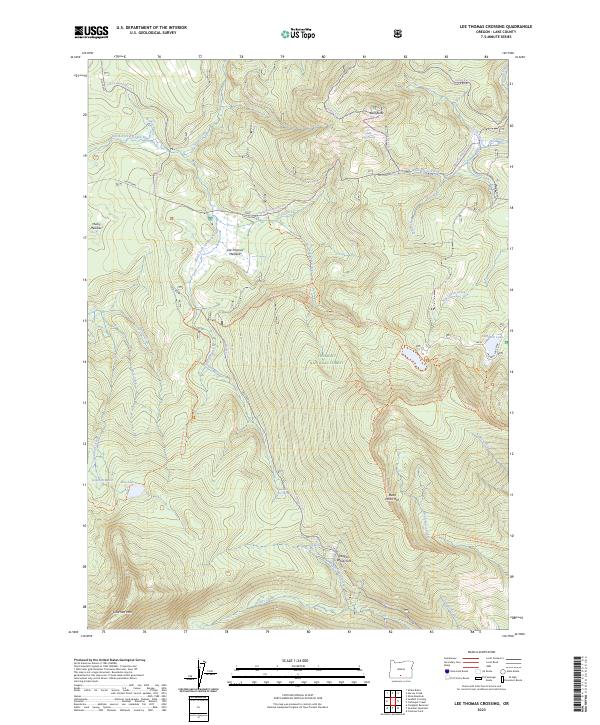
2023 Map of Lee Thomas Crossing
USGS Topo · Published 2023About this map
Gearhart Mountain Wilderness anchors the southern portion of this high-altitude landscape, where the volcanic massif of Gearhart Mountain rises above complex drainage networks. The North Fork Sprague River meanders through the central terrain, bordered by expansive open spaces like Lee Thomas Meadow and Mulky Meadow. These meadows represent critical clearings within the Fremont National Forest, historically significant for grazing and forest management. Small water bodies including Blue Lake and Campbell Lake dot the higher elevations near the prominent Dead Horse Rim. Transportation is defined by a legacy of forest access routes, including the Old Trunk and Trunk Road, which facilitate movement through this remote corner of Lake County. This survey detail captures the specific intersection of primitive backcountry trails and modern forest infrastructure at the small settlement of Lee Thomas.
Find a feature on this map
53 named features on this map. Tap any name to fly to it.
Don’t see what you’re looking for? This feature index may not catch every label — zoom into the map to look around manually.
Map Details
Editions of this 2023 Lee Thomas Crossing Map
This is the sole edition of this map. No revisions or reprints were ever made.
Other maps of this area

1955 · Klamath Falls
USGS Topo · 1:250,000

1958 · Klamath Falls
USGS Topo · 1:250,000

1960 · Fishhole Mtn
USGS Topo · 1:62,500

1964 · Coleman Point
USGS Topo · 1:24,000

1966 · Shake Butte
USGS Topo · 1:24,000

1966 · Slide Mtn
USGS Topo · 1:24,000

1966 · Sandhill Crossing
USGS Topo · 1:24,000

1966 · Harvey Creek
USGS Topo · 1:24,000

1966 · Coffeepot Creek
USGS Topo · 1:24,000

1966 · Lee Thomas Crossing
USGS Topo · 1:24,000