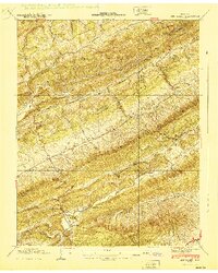
1940 Map of Lee Valley
USGS Topo · Published 1940About this map
Clinch Mountain and the parallel Poor Valley Ridge define the northeast-to-southwest grain of this 1940 landscape, which spans the border of Hancock and Hawkins Counties. The map reveals a deeply rural community structured around the narrow valleys of Big War Creek and Poor Valley Creek. A network of country schools and churches serves small settlements like Lee Valley and Wilder, including Duck Creek Sch and War Creek Ch. The settlement pattern follows the drainage, with family names preserved in sites like Morrell Cem and McGinnis Cem. A prominent Lookout Tower sits atop the high ridge between Flat Gap and Big War Gap, overlooking a terrain dominated by timber and subsistence agriculture before the post-war modernization of the region's rural roads.
Find a feature on this map
66 named features on this map. Tap any name to fly to it.
Don’t see what you’re looking for? This feature index may not catch every label — zoom into the map to look around manually.
Map Details
Editions of this 1940 Lee Valley Map
This is the sole edition of this map. No revisions or reprints were ever made.
Other maps of this area

1883 · Morristown
USGS Topo · 1:125,000

1887 · Jonesville
USGS Topo · 1:125,000

1891 · Jonesville
USGS Topo · 1:125,000

1893 · Morristown
USGS Topo · 1:125,000

1895 · Morristown
USGS Topo · 1:125,000

1932 · Hagan
USGS Topo · 1:62,500

1935 · Rogersville
USGS Topo · 1:48,000

1935 · Tate Springs
USGS Topo · 1:48,000

1935 · Kyles Ford
USGS Topo · 1:24,000

1935 · Lee Valley
USGS Topo · 1:24,000