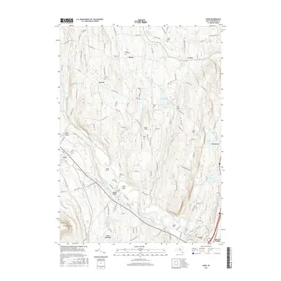
2016 Map of Leeds
USGS Topo · Published 2016About this map
Catskill Creek winds through this Greene County landscape, connecting the historic communities of Cairo and Leeds. The terrain is defined by the elevation of Potic Mtn and the striking Cairo Round Top, while the lowlands are marked by a dense concentration of family and community burial grounds. Genealogists can locate specific sites including the Waldron-Brandon Cem and Old Leeds Cem, which reflect the generations of settlement in this part of the Hudson Valley.
Find a feature on this map
144 named features on this map. Tap any name to fly to it.
Don’t see what you’re looking for? This feature index may not catch every label — zoom into the map to look around manually.
Map Details
Editions of this 2016 Leeds Map
This is the sole edition of this map. No revisions or reprints were ever made.
Other maps of this area

1892 · Kaaterskill
USGS Topo · 1:62,500

1893 · Kaaterskill
USGS Topo · 1:62,500

1893 · Coxsackie
USGS Topo · 1:62,500

1893 · Durham
USGS Topo · 1:62,500

1894 · Coxsackie
USGS Topo · 1:62,500

1894 · Kaaterskill
USGS Topo · 1:62,500

1894 · Durham
USGS Topo · 1:62,500

1895 · Catskill
USGS Topo · 1:62,500

1899 · Kaaterskill
USGS Topo · 1:62,500

1903 · Kaaterskill
USGS Topo · 1:62,500