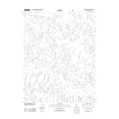
2012 Map of Leek Spring Hill
USGS Topo · Published 2012About this map
Meiss and the surrounding El Dorado County high country are defined by a complex network of forest service routes, including the Alder Ridge Forest Svc Rd, providing access to high-elevation vantage points. The prominence of Leek Spring Hill is marked by the Leek Spring Lookout, a critical point for fire surveillance that complements the Alder Ridge Lookout Tower further north. This landscape is deeply etched by the drainage systems of the N Fork Cosumnes River and the various forks of Camp Cr, which carve through prominent landforms like Baltic Ridge and Mill Creek Ridge. Small named locations such as Morrison and Pilliken indicate historical or administrative hubs within this timbered region. Water sources are meticulously noted, including Buckskin Joe Spring, Olyer Spring, and Ora Spring, which are vital landmarks in this drainage-rich terrain.
Find a feature on this map
32 named features on this map. Tap any name to fly to it.
Don’t see what you’re looking for? This feature index may not catch every label — zoom into the map to look around manually.
Map Details
Editions of this 2012 Leek Spring Hill Map
This is the sole edition of this map. No revisions or reprints were ever made.
Other maps of this area

1889 · Pyramid Peak
USGS Topo · 1:125,000

1891 · Pyramid Peak
USGS Topo · 1:125,000

1895 · Pyramid Peak
USGS Topo · 1:125,000

1896 · Pyramid Peak
USGS Topo · 1:125,000

1947 · Sacramento
USGS Topo · 1:250,000

1948 · Sacramento
USGS Topo · 1:250,000

1950 · Riverton
USGS Topo · 1:24,000
1951 · Stump Spring
USGS Topo · 1:24,000

1951 · Leek Spring Hill
USGS Topo · 1:24,000
1951 · Caldor
USGS Topo · 1:24,000