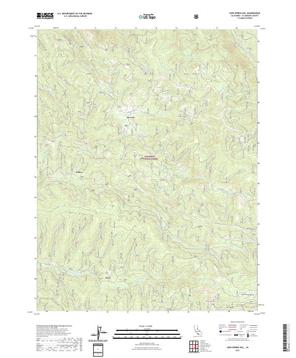
2021 Map of Leek Spring Hill
USGS Topo · Published 2021About this map
Eldorado National Forest encompasses this high-elevation landscape, where the Sierra Nevada terrain is defined by a series of prominent ridges and deep river canyons. The northern reaches are carved by the Silver Fork American River, while the southern portion features the headwaters of the North Fork Cosumnes River and South Fork Cosumnes River. These drainage systems are separated by significant landforms like Iron Mtn Ridge and Plummer Ridge. Small, isolated settlements such as Pilliken, Morrison, and Meiss are connected by a network of Forest Service roads and trails. The map highlights numerous named water sources, including Buckskin Joe Spring and Ora Spring, which have long been vital markers for navigation and survival in this timber-dense backcountry. The convergence of multiple township boundaries illustrates the complex administrative surveying of these mountain slopes, while the Caldor Loop Trl suggests the area's continued use for forest access and recreation.
Find a feature on this map
53 named features on this map. Tap any name to fly to it.
Don’t see what you’re looking for? This feature index may not catch every label — zoom into the map to look around manually.
Map Details
Editions of this 2021 Leek Spring Hill Map
This is the sole edition of this map. No revisions or reprints were ever made.
Other maps of this area

1889 · Pyramid Peak
USGS Topo · 1:125,000

1891 · Pyramid Peak
USGS Topo · 1:125,000

1895 · Pyramid Peak
USGS Topo · 1:125,000

1896 · Pyramid Peak
USGS Topo · 1:125,000

1947 · Sacramento
USGS Topo · 1:250,000

1948 · Sacramento
USGS Topo · 1:250,000

1950 · Riverton
USGS Topo · 1:24,000
1951 · Stump Spring
USGS Topo · 1:24,000

1951 · Leek Spring Hill
USGS Topo · 1:24,000
1951 · Caldor
USGS Topo · 1:24,000