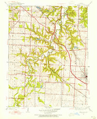
1949 Map of Lees Summit
USGS Topo · Published 1954About this map
The Little Blue River carves a winding path through Jackson County, defining the rural character of this landscape in the years following World War II. While Lees Summit appears as a developing hub at the intersection of the Missouri Pacific and Chicago Rock Island and Pacific railroads, the surrounding townships are dotted with the essential markers of mid-century community life. Numerous country schools, including Stony Point Sch and Cedar Hill Sch, serve the outlying farmsteads, while the Floral Hills Cemetery and Gregory Landing Field indicate the encroaching influence of Kansas City from the northwest. Notable landmarks like the Unity Tower and the small settlement at Knobtown provide distinct navigational points in an area transitioning from purely agricultural use to a more connected suburban-rural fringe.
Find a feature on this map
34 named features on this map. Tap any name to fly to it.
Don’t see what you’re looking for? This feature index may not catch every label — zoom into the map to look around manually.
Map Details
Editions of this 1949 Lees Summit Map
This is the sole edition of this map. No revisions or reprints were ever made.
Other maps of this area

1887 · Harrisonville
USGS Topo · 1:125,000

1887 · Olathe
USGS Topo · 1:125,000

1890 · Kansas City
USGS Topo · 1:125,000

1892 · Harrisonville
USGS Topo · 1:125,000

1893 · Olathe
USGS Topo · 1:125,000

1894 · Kansas City
USGS Topo · 1:125,000

1894 · Harrisonville
USGS Topo · 1:125,000

1894 · Independence
USGS Topo · 1:125,000

1933 · Blue Springs
USGS Topo · 1:24,000

1934 · Independence
USGS Topo · 1:24,000