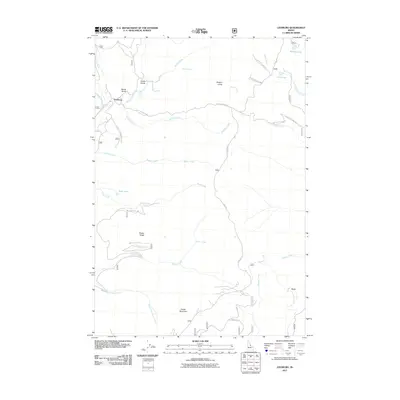
2011 Map of Leesburg
USGS Topo · Published 2011About this map
Leesburg anchors this 2011 survey of the Salmon River Mountains, a landscape defined by sharp elevation changes and high-altitude hydrology. The map traces the intricate drainage patterns of the region, from the headwaters of Napias Creek near Devlin Falls to the high waters of Wallace Lake and U P Lake. Topographic details reveal a history of resource extraction and mountain access, marked by numerous gulches like Smith Gulch, Wards Gulch, and Oregon Gulch. The southern portion of the quadrangle is dominated by the massive profile of Phelan Mountain and Phelan Ridge, with local landmarks such as Crib Spring providing vital water points in the high country. Primitive roads and trails, including the Perreau Crk Tr and the Nat For Dev Rd 082, weave through the drainage basins of Rabbit Creek and Pony Creek, illustrating the remote connectivity of this Idaho backcountry.
Find a feature on this map
35 named features on this map. Tap any name to fly to it.
Don’t see what you’re looking for? This feature index may not catch every label — zoom into the map to look around manually.
Map Details
Editions of this 2011 Leesburg Map
This is the sole edition of this map. No revisions or reprints were ever made.
Other maps of this area

1950 · Salmon
USGS Topo · 1:62,500

1950 · Leesburg
USGS Topo · 1:62,500

1951 · Leesburg
USGS Topo · 1:62,500

1951 · Salmon
USGS Topo · 1:62,500

1955 · Dillon
USGS Topo · 1:250,000

1956 · Elk City
USGS Topo · 1:250,000

1957 · Dillon
USGS Topo · 1:250,000

1958 · Dillon
USGS Topo · 1:250,000

1960 · Elk City
USGS Topo · 1:250,000

1960 · Ulysses Mtn
USGS Topo · 1:62,500