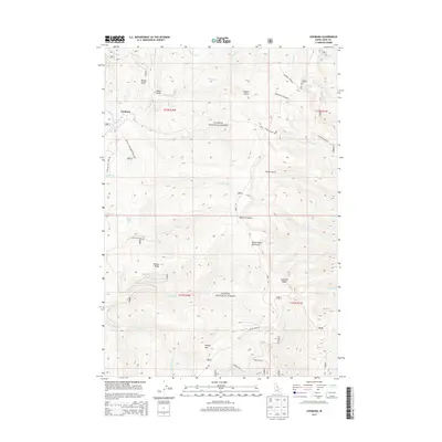
2013 Map of Leesburg
USGS Topo · Published 2013About this map
The settlement of Leesburg serves as the focal point for this portion of the Salmon National Forest, situated within the high terrain of the Salmon River Mountains. The landscape is defined by a complex network of drainages and peaks, including Phelan Mtn and the prominent Gutzman Ridge. High-altitude water bodies such as Wallace Lake, U P Lake, and Pony Lake are scattered across the quadrangle, connected by various creeks like Napias Cr and Sharkey Cr.
Find a feature on this map
44 named features on this map. Tap any name to fly to it.
Don’t see what you’re looking for? This feature index may not catch every label — zoom into the map to look around manually.
Map Details
Editions of this 2013 Leesburg Map
This is the sole edition of this map. No revisions or reprints were ever made.
Other maps of this area

1950 · Salmon
USGS Topo · 1:62,500

1950 · Leesburg
USGS Topo · 1:62,500

1951 · Leesburg
USGS Topo · 1:62,500

1951 · Salmon
USGS Topo · 1:62,500

1955 · Dillon
USGS Topo · 1:250,000

1956 · Elk City
USGS Topo · 1:250,000

1957 · Dillon
USGS Topo · 1:250,000

1958 · Dillon
USGS Topo · 1:250,000

1960 · Elk City
USGS Topo · 1:250,000

1960 · Ulysses Mtn
USGS Topo · 1:62,500