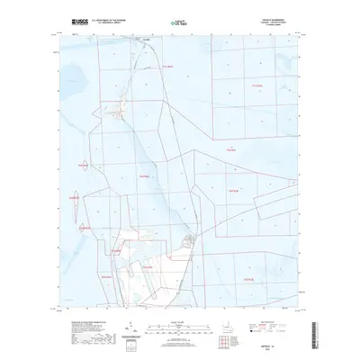
2020 Map of Leeville
USGS Topo · Published 2020About this map
Leeville sits as a critical outpost in the marshlands of Lafourche Parish, centered on the crossing of Bayou Lafourche. This 2020 landscape is defined by its intricate network of waterways and canals that support the regional maritime and petroleum economies. The map traces the modern infrastructure of the La 1 Toll RD and the Leeville Bridge alongside remnants of older thoroughfares like Old State Rte 1 and Old Hwy 1 S. The surrounding terrain is dominated by vast brackish basins and tidal bayous, including Hackberry Bay, Timbalier Bay, and Bayou Moreau. Inland, the grid of the Southwestern Louisiana Canal and the Havoline Canal speaks to the heavy industrial engineering required to navigate and manage this low-lying delta region. Smaller local roads such as A O Rappelet Rd and N J Theriot Rd provide access to landing sites and maritime facilities near the edge of the Gulf of Mexico.
Find a feature on this map
31 named features on this map. Tap any name to fly to it.
Don’t see what you’re looking for? This feature index may not catch every label — zoom into the map to look around manually.
Map Details
Editions of this 2020 Leeville Map
This is the sole edition of this map. No revisions or reprints were ever made.
Other maps of this area

1892 · Cheniere Caminada
USGS Topo · 1:62,500

1892 · Creole
USGS Topo · 1:62,500

1894 · Timbalier
USGS Topo · 1:62,500

1894 · Lake Felicity
USGS Topo · 1:62,500

1935 · Bay Courant
USGS Topo · 1:31,680

1935 · Pelican Pass
USGS Topo · 1:31,680

1935 · Mink Bayou
USGS Topo · 1:31,680

1935 · Calumet Island
USGS Topo · 1:31,680

1935 · Leeville
USGS Topo · 1:31,680

1939 · Lake Felicity
USGS Topo · 1:62,500