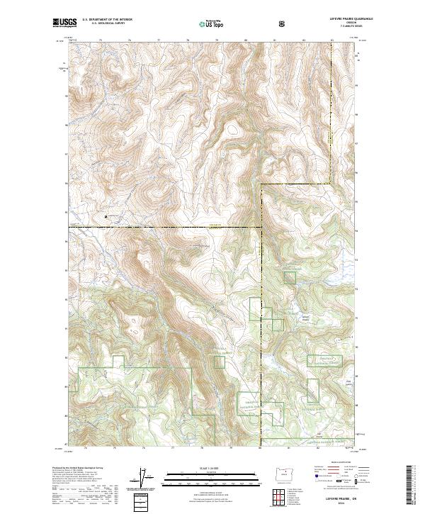
2024 Map of Lefevre Prairie
USGS Topo · Published 2024About this map
The Umatilla National Forest dominates the southern half of this landscape, where high plateaus like Lefevre Prairie, Pool Prairie, and Lee Prairie overlook a complex network of drainages. The northern portion of the map is defined by deep incisions in the terrain, including Buttermilk Canyon, Pullen Canyon, and the parallel paths of Little Dutch Canyon and Big Dutch Canyon. Local history is anchored by the Lonerock Cem near Brown Creek, providing a focal point for genealogical research in this sparsely settled region. Movement through the area relies on established routes such as Huddelston Rd and Lone Rock Rd, which connect the scattered water sources like Brandenburg Reservoir and Perry Spring. The map captures a high-desert environment where topographic features like The Frog and Long Hollow serve as critical landmarks across the Gilliam, Morrow, and Wheeler county lines.
Find a feature on this map
36 named features on this map. Tap any name to fly to it.
Don’t see what you’re looking for? This feature index may not catch every label — zoom into the map to look around manually.
Map Details
Editions of this 2024 Lefevre Prairie Map
This is the sole edition of this map. No revisions or reprints were ever made.
Other maps of this area

1953 · Kimberly
USGS Topo · 1:62,500

1953 · Spray
USGS Topo · 1:62,500

1953 · Pendleton
USGS Topo · 1:250,000

1955 · Canyon City
USGS Topo · 1:250,000

1956 · Pendleton
USGS Topo · 1:250,000

1959 · Canyon City
USGS Topo · 1:250,000

1969 · Lefevre Prairie
USGS Topo · 1:24,000

1969 · Buttermilk Canyon
USGS Topo · 1:24,000
1969 · Lonerock
USGS Topo · 1:24,000

1969 · Chapin Creek
USGS Topo · 1:24,000