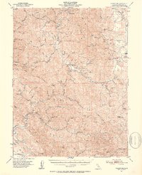
1969 Map of Leggett
USGS Topo · Published 1994About this map
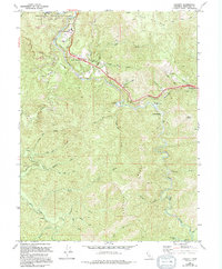
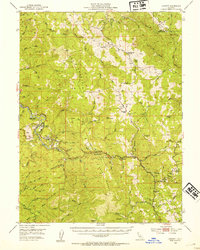
The South Fork Eel River winds through this northern Mendocino County landscape, where the confluence of major drainage systems once defined the local timber and tourism economy. The community of Leggett serves as a focal point, situated near the Standish-Hickey State Recreation Area and the famed Chandelier Tree. As of this 1960s survey, the area was a critical junction for travelers, marking the meeting of U S Highway 101 and State Highway 1. The map reveals a transition from valley settlements like South Leggett and Cummings to the steep, densely creek-fed terrain of Elkhorn Ridge. Along the river’s path, features like the Gaging Station and various Prospects suggest a land tied closely to its natural resources and hydrologic monitoring. Small enclaves such as Camp St Michael and The Hermitage are tucked into the bends of Rattlesnake Creek, illustrating the remote residential patterns of the coastal range.
Find a feature on this map
56 named features on this map. Tap any name to fly to it.
Don’t see what you’re looking for? This feature index may not catch every label — zoom into the map to look around manually.
Map Details
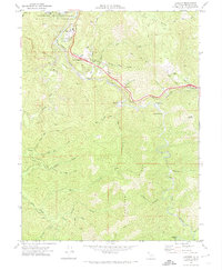
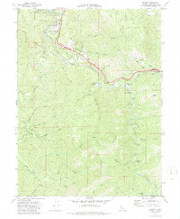
Editions of this 1969 Leggett Map
3 editions found
Other maps of this area

1920 · Cummings
USGS Topo · 1:62,500

1921 · Westport
USGS Topo · 1:62,500

1921 · Branscomb
USGS Topo · 1:62,500
1950 · Piercy
USGS Topo · 1:62,500
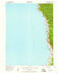
1950 · Cape Vizcaino
USGS Topo · 1:62,500

1951 · Cape Vizcaino
USGS Topo · 1:62,500
1951 · Branscomb
USGS Topo · 1:62,500
1952 · Leggett
USGS Topo · 1:62,500

1957 · Ukiah
USGS Topo · 1:250,000

1960 · Ukiah
USGS Topo · 1:250,000