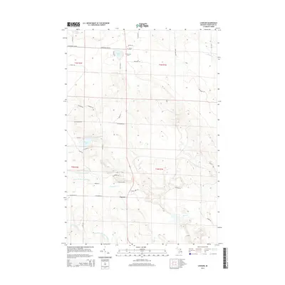
2014 Map of Legrand
USGS Topo · Published 2014About this map
Legrand is a central focal point in this portion of Cheboygan County, where local roads such as W Ostrander Rd and Michigan St converge. The landscape is defined by its complex drainage systems, including the N Br Little Pigeon River and Middle Br Little Pigeon River, which flow westward toward the shores of Mullett Lake. These watercourses, along with smaller tributaries like Morrow Cr and Adair Cr, indicate a low-lying, water-rich environment typical of this region of Northern Michigan.
Find a feature on this map
49 named features on this map. Tap any name to fly to it.
Don’t see what you’re looking for? This feature index may not catch every label — zoom into the map to look around manually.
Map Details
Editions of this 2014 Legrand Map
This is the sole edition of this map. No revisions or reprints were ever made.
Other maps of this area

1955 · Cheboygan
USGS Topo · 1:250,000

1957 · Tower
USGS Topo · 1:62,500

1957 · Wolverine
USGS Topo · 1:62,500

1957 · Cheboygan
USGS Topo · 1:62,500

1957 · Mullett Lake
USGS Topo · 1:62,500

1958 · Cheboygan
USGS Topo · 1:250,000

1982 · Petoskey
USGS Topo · 1:100,000

1982 · Aloha
USGS Topo · 1:25,000
1982 · Mullett Lake
USGS Topo · 1:25,000
1982 · Manning
USGS Topo · 1:25,000